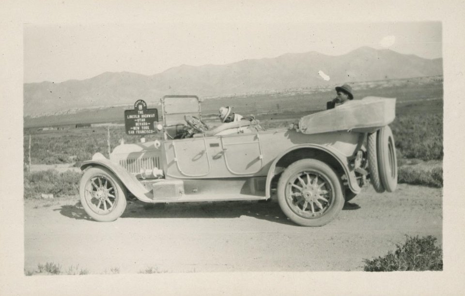
 1 “Lincoln Highway car at Utah-Nevada state line, Utah.” University of Michigan Library Digital Collections. |
 2 “Midland Trail between Goldfield and Tonopah, Nevada, Midland Trail.” University of Michigan Library Digital Collections. |
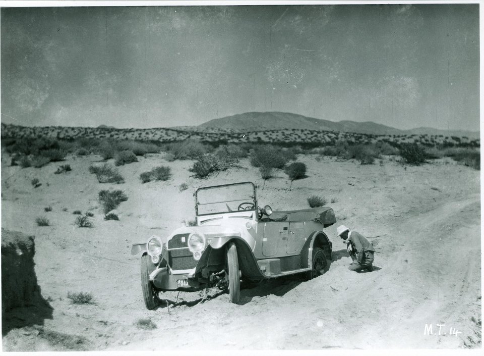
 3 “Desert 20 miles south of Goldfield, Nevada, Midland Trail, 1917.” University of Michigan Library Digital Collections |
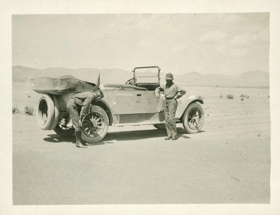
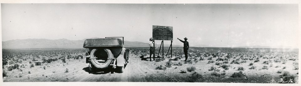
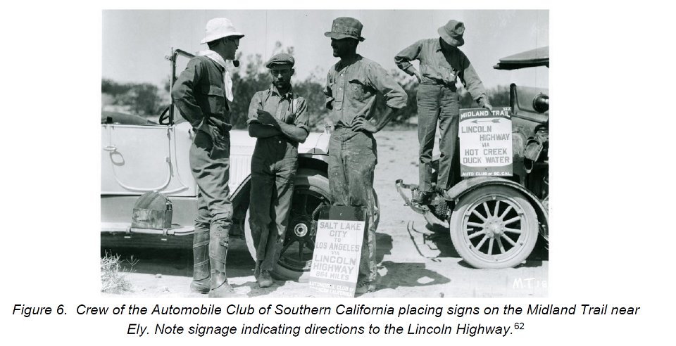
 4 “Gael S. Hoag, Nevada State Consul, and Austin F. Bement, Secretary of the Lincoln Highway Association, south of Goldfield, Nevada, Midland Trail.” University of Michigan Library Digital Collections. |
 5 “Gael S. Hoag, Nevada State Consul, and Austin F. Bement, Secretary of the Lincoln Highway Association, south of Goldfield, Nevada, Midland Trail.” University of Michigan Library Digital Collections. |
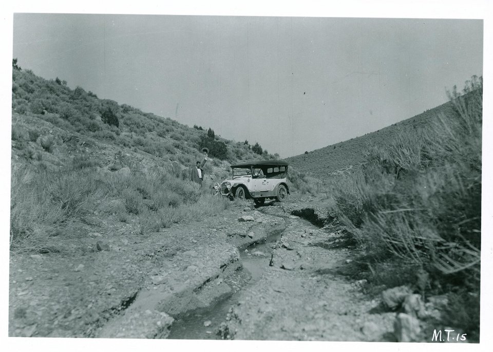
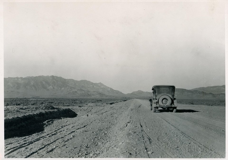
 6 “Midland Trail east of Goldfield, Nevada.” University of Michigan Library Digital Collections. |
 7 “Gael S. Hoag, Nevada State Consul, and Austin F. Bement, Secretary of the Lincoln Highway Association, south of Goldfield, Nevada, Midland Trail.” University of Michigan Library Digital Collections |
 8 “Gael S. Hoag, Nevada State Consul, and Austin F. Bement, Secretary of the Lincoln Highway Association, south of Goldfield, Nevada, Midland Trail.” University of Michigan Library Digital Collections |
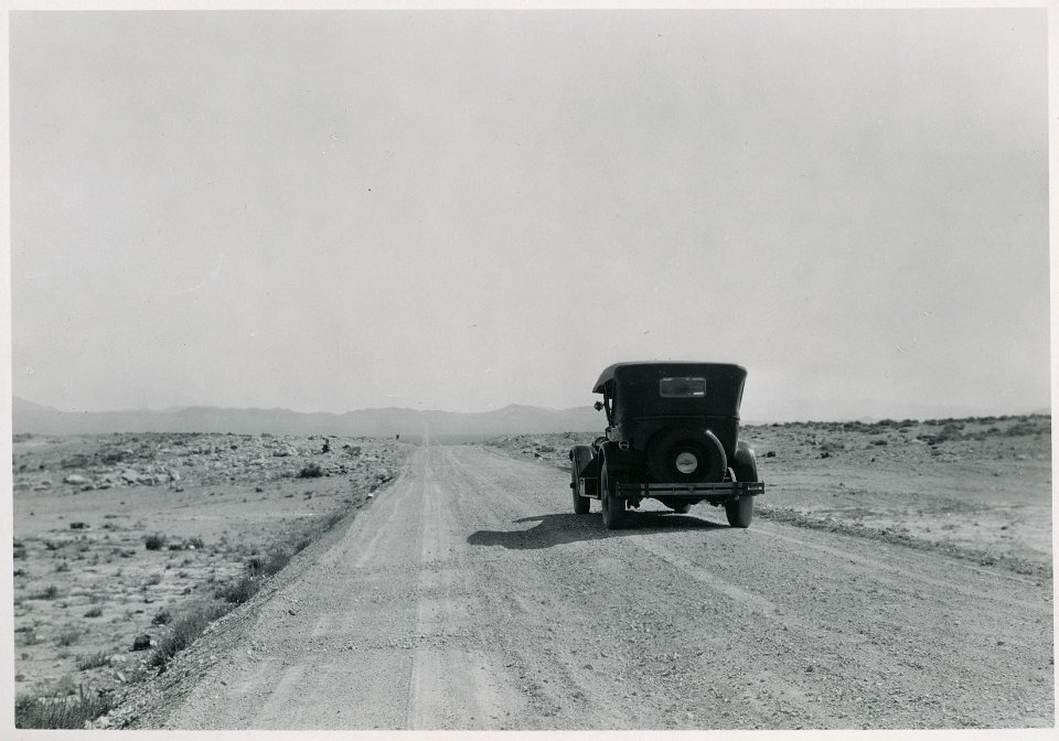
 9 “On the Midland Trail between Tonopah and Goldfield, Nevada.” University of Michigan Library Digital Collections. |
 10 “The Midland Trail in the Railroad Valley, 10 miles from the Currant post office, Nevada.” 1924. University of Michigan Library Digital Collections. |
 11 “The Midland Trail from Currant, Nevada; gravel deposits in borrow pits.” 1924. University of Michigan Library Digital Collections. |
 12 “Sign between Tippets and Anderson's Ranch, White Pine County, Nevada.” University of Michigan Library Digital Collections. Accessed: December 11, 2021. |
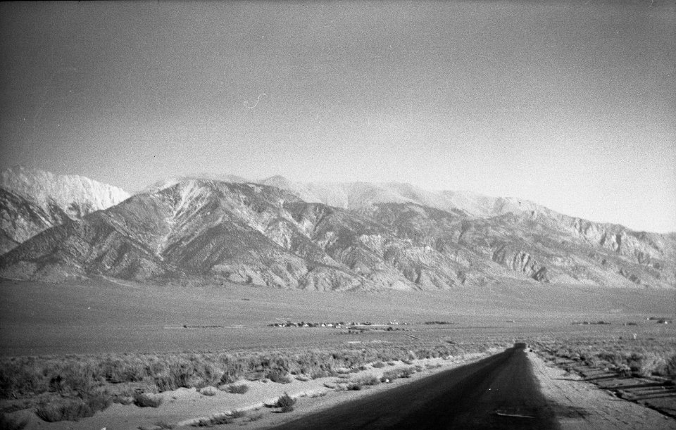
 13 “On the Midland Trail between Goldfield, Nevada and Big Pine, California.” University of Michigan Library Digital Collections. |
 14 Henchey, Paul L. (1951, October 8). Stage coach stop, Old Midland Trail, Stone Cabin, Nevada, courtesy UC Davis Library, Archives and Special Collections |
 15 Henchey, Paul L. 1951. “‘Midland Trail’ Sign Post, Old Roach Tonopah, Ely, Nevada, SV-335.” Henchey (Paul L.) Photographs. UC Davis Library, Archives and Special Collections. October 10, 1951. |
 16 |
 17 “Concrete and steel bridge 32 miles south of Ely, Nevada, Midland Trail.” University of Michigan Library Digital Collections |
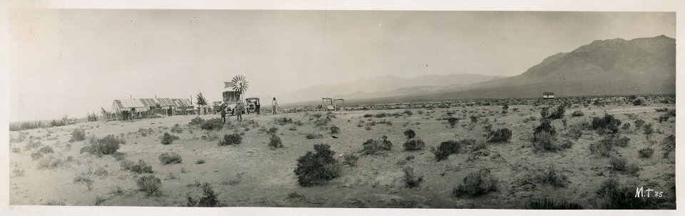 18 “Nyala Post Office, Nevada, Midland Trail, 1917.” University of Michigan Library Digital Collections. |
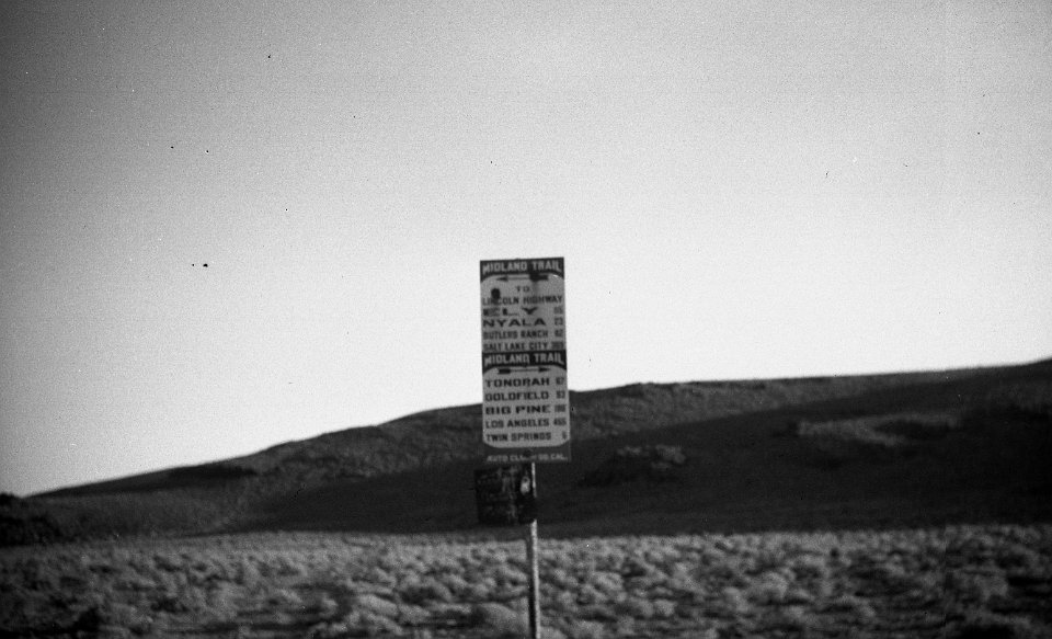
 19 “On the Midland Trail between Tonopah and Nyala Post Office, Nevada; shown are the steel enameled signs placed by the Automobile Club of Southern California.” University of Michigan Library Digital Collections. |
 20 “Crossing Wymar Creek, 91 miles southwest of Tonopah, Nevada, Midland Trail.” University of Michigan Library Digital Collections. Accessed: December 07, 2021. |
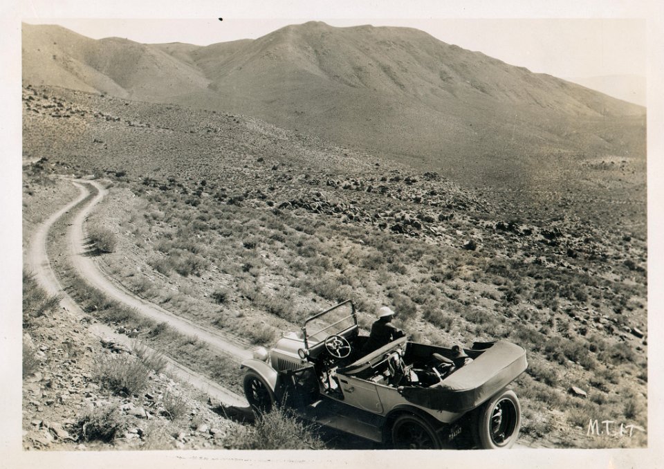
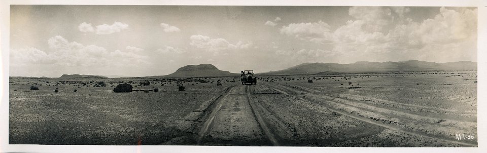 21 “Midland Trail near Goldfield, Nevada, 1917.” University of Michigan Library Digital Collections. |
 22 “Austin F. Bement and Gael S. Hoag on the Midland Trail near Tonopah, Nevada, 1917.” University of Michigan Library Digital Collections. |
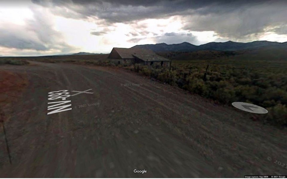 23 A lousy photo of Stone House on SR 893, courtesy Google Maps, from 2009. |
 24 Junction of US 93 and SR 893 at Schellbourne, looking NE, courtesy Google Maps, 2018 |
 25 Lida junction on US 95 looking SW, courtesy Google Maps 2021 |
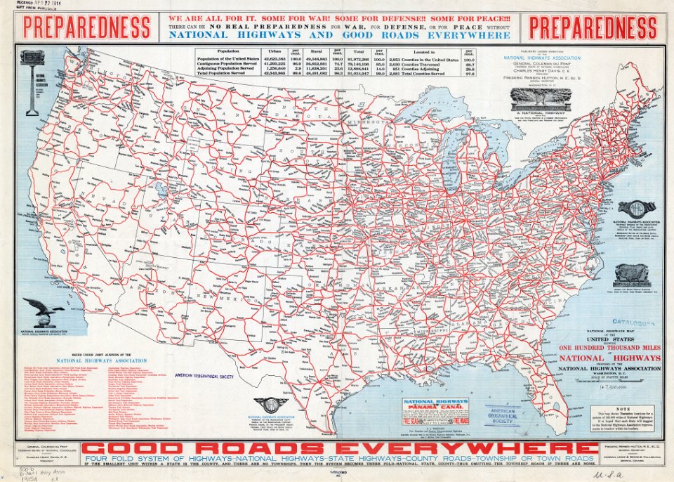
 26 Jenkins, E. E. Cartographer, John C. Cartographer Mulford, National Highways Association Creator, and P. A. Cartographer Rosendorn. Map of United States Proposed National Highways System. Washington, D.C.: National Highways Association, 1915. Map. https://www.loc.gov/item/2021668524/. |
 27 Jenkins, E. E. Cartographer, John C. Cartographer Mulford, National Highways Association Creator, and P. A. Cartographer Rosendorn. Map of United States Proposed National Highways System. Washington, D.C.: National Highways Association, 1915. Map. https://www.loc.gov/item/2021668524/. Nevada portion |
 28 Mulford, John C. Cartographer, and National Highways Association Creator. Map of United States Proposed National Highways. Washington, D.C.: National Highways Association, 1915. Map. https://www.loc.gov/item/2021668523/. |
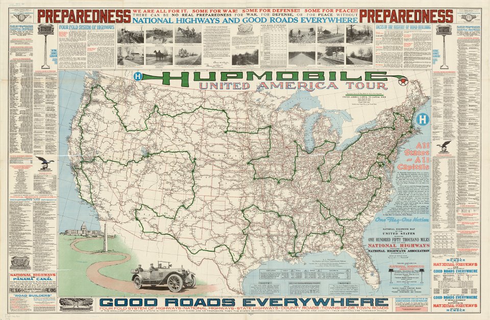 29 American Lithographic Company Printer, and National Highways Association Creator. Hupmobile United America Tour. Washington, D.C.: National Highways Association, 1918. Map. https://www.loc.gov/item/2021668528/. |
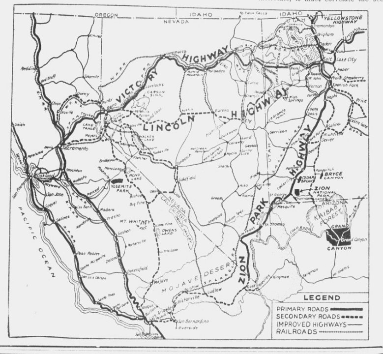
 30 Nevada portion of American Lithographic Company Printer, and National Highways Association Creator. Hupmobile United America Tour. Washington, D.C.: National Highways Association, 1918. Map. Note how Midland Trail is split by map maker between Ely and Tonopah |
 31 |
 32 |
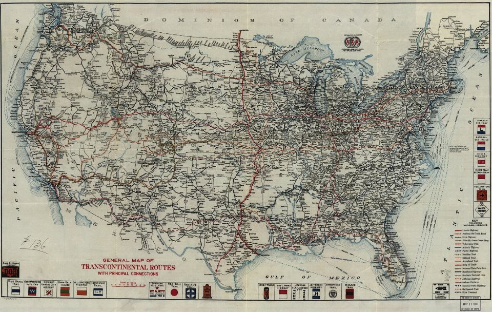
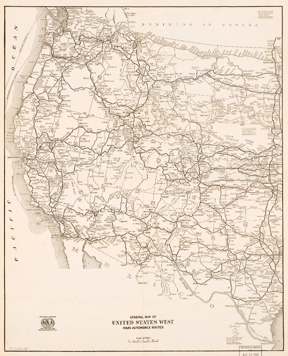 33 American Automobile Association. General map of United States west main automobile routes. Washington, D.C., to 1920, 1916. Map. https://www.loc.gov/item/73693095/ |
 34 American Automobile Association. General map of United States west main automobile routes. Washington, D.C., to 1920, 1916. Map. https://www.loc.gov/item/73693095/ Showing only Nevada portion. |
 35 |
 36 Rand McNally map in 1922 showing most if not all of the auto trails existing at that time. |
 37 Map printed in the Tonopah Daily Bonanza, February 6, 1922 |
 38 1925 Roosevelt Midland Trail Association map |
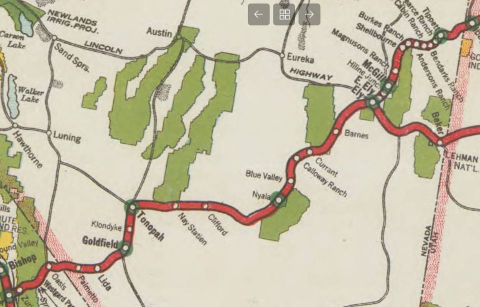 39 The Nevada portion of the map. |
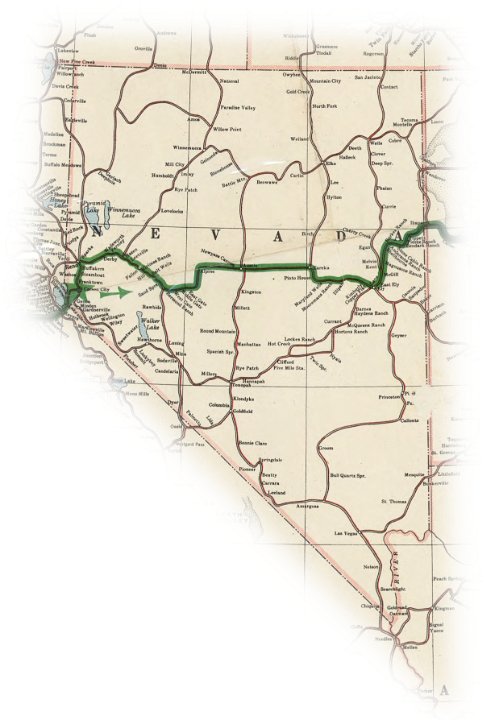
 40 The Nevada portion of the Midland Trail, from a Rand McNally 1925 Junior Road Map, showing the "improved" and "unimproved" sections of the Trail. |
 41 |
 42 The official 1939 State of Nevada Road map now shows the eastern and western Nevada portions of the Midland Trail degraded to dirt roads. |
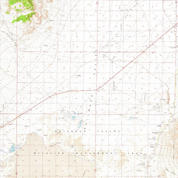 43 BLUE EAGLE SPRINGS USGS map showing US6 in red and original Midland Trial highlighted in yellow in lower right |
 44 |
 45 Add from the 1916 Midland Trail Tour Guide. |